Only a short distance down the road from Basantapur lies the bustling, one-street, hill-village of Hille - the starting point for the trek to the isolated, uninhabited Barun Valley and the base camp beneath Mount Makalu - ( "the Great Black One" ) - the world's fifth highest mountain and one of the truly great peaks of the Himalaya.
The route initially follows the course of the mighty Arun River through small settlements of thatch-roofed, wickerwork houses surrounded by rice paddies and fields of tall sugar cane and maize. Smiling children shout greetings: " Namaste! Have you a pen? ".
I was accompanied by four trekking staff:- my Tibetan sirdar John Lama and three Sherpas: our cook Lakpa and his two assistants Dorje and Ringi - both on their first trek and being trained by Lakpa as kitchenboys. All four came from the same remote village in the Makalu region. While we were still unloading the roofrack of the bus at the trailhead in Hille, John managed to recruit a team of eight local porters - seven Gurungs and one Tamang - to carry our huge stack of camping equipment and food supplies.
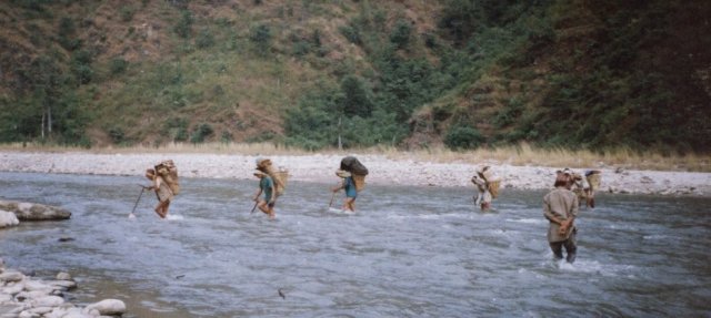 Porters fording
the Irkuah Khola
|
Leaving the riverside beyond the sprawling village of Tumlingtar, with its small, grass airstrip, the trail winds up through terraced hillsides to the substantial town of Khandbari with its flagstoned pavements and three-storied, stone-built, shop-houses.
From Khandbari our route led along a forested ridgetop with occasional views to river valleys far below. We encamped at the small settlement of Chichira and again at the larger village of Num situated in a spectacular location on a promontory high above the Arun River surrounded by a huge cirque of rugged mountains cleft by deep gullies and narrow valleys. A precipitous 2000ft descent to an airy suspension bridge across the raging waters of the Arun River, confined in a rocky defile, was followed by an equally steep re-ascent to the village of Sedua - an all-day journey but only a short distance on the map.
The lush sub-tropical vegetation soon gave way to rhododendron and pine forests as we contoured round and up the hillside to the remote Sherpa village of Tashigaon - an eight-days walk from the nearest roadhead. Our Gurung porters now wished to return to their village to celebrate Tihar ( one of the two main Nepali festivals, the other, only a couple of weeks before, is Dasain ). They also had no desire or proper clothing to proceed to the harsher conditions expected in the route ahead and were replaced, only after a long search and at higher cost, with four local Sherpas inured to the altitude and cold of the high valleys.
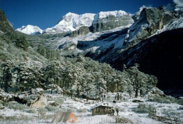
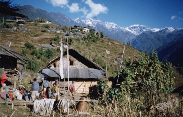 Tashigaon
Village
|
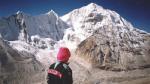
Tashigaon is the last permanent settlement and above lies the crux of the route to Makalu base camp - a series of three high passes blocking the way to the isolated Barun Valley. On the long hard slog up through the densely forested hillside there were occasional views of the Kasuwa Khola in the valley floor far below.
Crossing the Keke La, the first of these passes, we gained our first views of the snow peaks - the white massif of Chamlang rising at the head of the Iswa Valley and the summit cone of Makalu protruding above a high ridgetop. The highest pass, Shipton La at some 4500metres was soon reached but had been enveloped in heavy mist. A short drop to a dark, foreboding, corry lochan and re-ascent to the third col, Tutu La, was then followed by a long descent through shrub rhododendron to the small campsite amidst tall pine trees at Mumbuk.
Another knee-jarring plunge down a steep, rocky gully ended on the banks of the turbulent waters of the Barun Khola enclosed in its narrow valley beneath towering mountainsides. Initially rough boulder fields of savage landslips made progress difficult but then pleasant, level meadows led on to a widening of the glaciated valley where sheer rock walls, reminiscent of those in Yosemite, marked the gateway to the upper valley and a spectacular range of himalayan peaks.
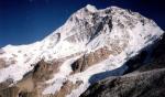
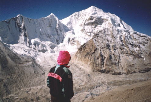
 Peak 6 ( Mount
Tutse ) and Peak 4
in the Barun Valley |
Above the tree-line we climbed over open moorland beneath the imposing but nameless Peak 7 past the huts at Jark Kharka to a col for a breathtaking view of the massive Mt.Tutse ( Peak 6 ) and the adjoining Peak 4 looming directly ahead before the trail dropped to follow the Barun river trapped beneath a long, lateral moraine and the scree slopes and rocks of the valley side.
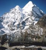
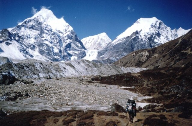
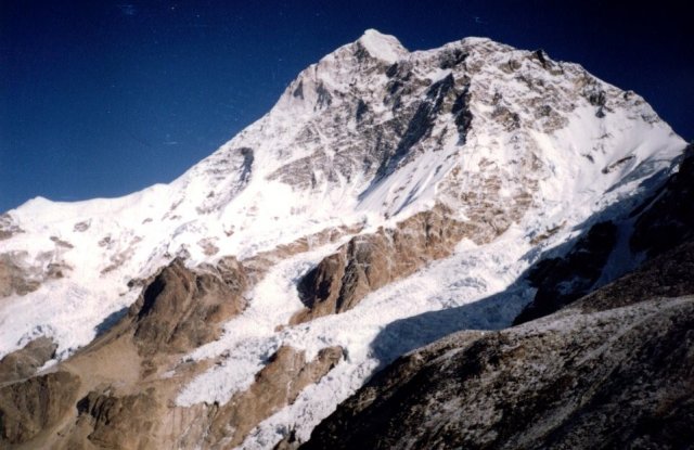 Mt. Makalu from
above Shershon
|
On a clear, crisp morning I scaled the stony, moss-covered hillside above the campsite at Shershon to attain a superb 360 degree view of the surrounding peaks; most unnamed and identified only by their survey numbers. Bounding the glaciated valley to the south arose the ice-hung aretes of Peak 6 ( Mt.Tutse ) and Peak 4 while to the north were the pointed summits of Peak 3 and Peak 5. However these were all eclipsed by the majestic Makalu with its soaring ridges and sheer granite faces sweeping skywards only a stone's-throw away. Walking across to the western edge of the plateau I looked down to the Barun Pokhari and on up the great glacier to the two other 8000 metre giants of Lhotse and Everest.
From Shershon it is only a short distance further up the valley to the site, on wide gravel flats, for the base camps for climbing expeditions to Mount Makalu. Beyond base camp we followed a faint trail, marked by small cairns, over the rough convoluted moraines of the Barun Glacier to Advanced Base Camp and, next day, accompanied by Lakpa and Dorje, I scrambled up a rocky ridge to a height of some 6000metres directly beneath the imposing north-west face of Makalu.
 Mt. Baruntse
from above Makalu Advanced Base Camp |
Across the glacier long, crenellated ridges of rock and snow peaks culminated in the magnificent, 7000 metre Mount Baruntse. We could see the notch of Sherpani Col marking the hazardous, high-level crossing to the secluded and seldom visited Hongu Valley.
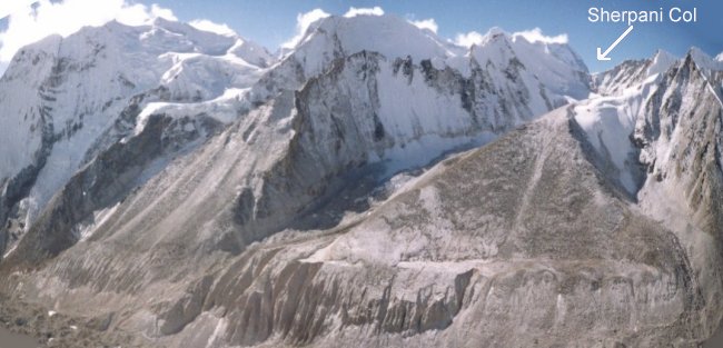 Sherpani Col
from above Makalu Advanced Base Camp |
Back at base camp the sirdar of a German group had commandeered two of our Sherpa porters and John and Lakpa had to carry dokos ( wickerwork baskets for loads ) back to Tashigaon.
On our return journey down the Barun Valley it snowed every afternoon giving John some concern for our re-crossing of Shipton La. However, after an early morning start from Mumbuk, and a long arduous plod through deep soft snow, we were fortunate to reach the col just before the start of another blizzard.
 Peak 3 and Peak
5
from Barun Valley |
From Khandbari we took a different route out through the ridgetop town of Chainpur and, on the final ridgetop above the roadhead at Basantapur, were rewarded with a splendid panorama of Chamlang and the Makalu Himal stretched along the northern horizon some 70 miles afar.
( From "Heavenly Pursuits", Weekend Extra, Glasgow Herald, 17th August 1996 )
Himalaya Map - Nelles ( UK , USA )
Nepal Trail Map - Nelles ( UK , USA )