
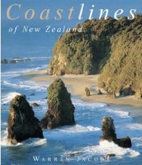
 |
|
|
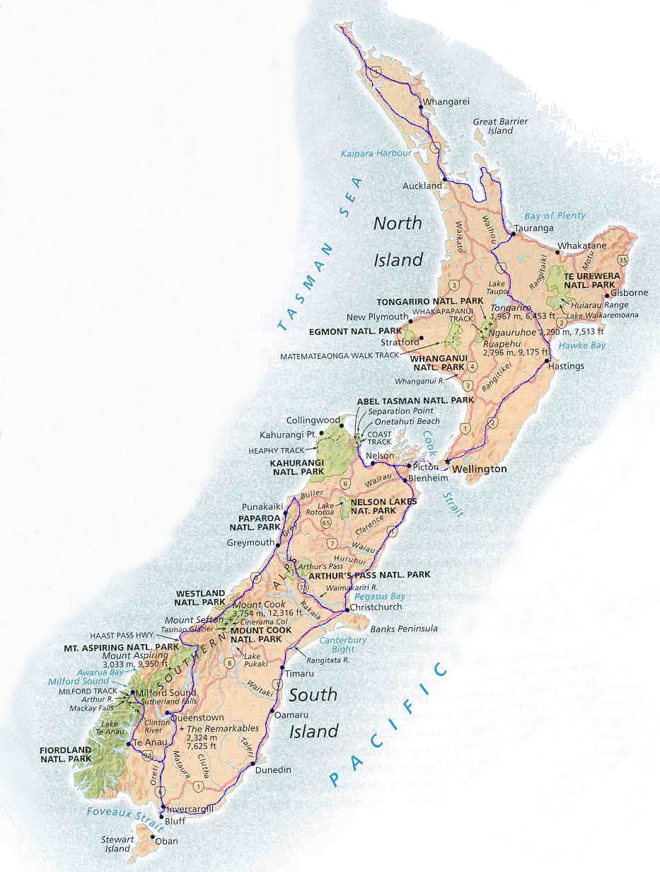
Aukland
- Christchurch : Mt.
Cook
National Park
: Queenstown & Fjordland : Wanaka & Mt. Aspiring National Park

After three days making arrangements, shopping and exploring the modern, cosmopolitan city of Auckland I travelled by Inter-city bus to Wellington and then by Inter-Islander ferry to reach Mt. Cook village in the heart of the Southern Alps.
On route I spent a day strolling around the pleasant cathedral town of Christchurch with its old ( for NZ ) stone buildings and extensive Botanical Gardens complete with picturesque River Avon (named after the Scottish one) before crossing the flat expanse of the Canterbury plains with extensive lines of trees planted as windbreaks for protection of crops and livestock.
 )
)Mount Cook is one of many National Parks run by the Department of Conservation ( DoC ). The Visitor Centres are mines of information on local walks, history, geology, flora and fauna and a mandatory first stop.
I pitched my tent ( bought in Aukland ) in the grassy meadows of White Horse campsite surrounded by extensive forest ( or bush as it is known in NZ ) beneath the towering snow and ice slopes of Mt.Sefton. The squawking of Keas, an alpine parrot unique to NZ, emanated from the trees and occasionally the birds emerged in their drab green plumage to forage inquisitively about the tents.
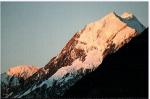
On a fine, clear sunny morning I climbed through the needle grass scrub and across loose scree slopes to gain the Mueller hut for a close-up view of Mt.Sefton and then continued upwards along a rocky ridge to the summit of Mt. Kitchener (2044m, c6600ft) and a superb panorama of the surrounding peaks and glaciers including the majestic Mt. Cook rising abruptly above Hooper Lake.
Bad weather prevailed for several days when fierce NW winds and heavy rain battered the camp-site - the onset of each squall being heralded by the howling of the wind through the tree tops - several tents suffered broken poles and torn fly sheets.
With an improvement in the weather I walked up the Hooker river valley and over rugged moraines to the foot of the Copland Pass - a hiking route across the Divide (the backbone of the Alps). Across the valley loomed the complex west face of Mt. Cook.
In the evenings the Southern Cross was prominent in a star-spangled sky.
On another day I hired a mountain bike and cycled the 8 km along the rough, unsurfaced Ball road and climbed the ridge above the roadhead for a fine view up the Tasman glacier to the graceful Minarets. Immediately overhead towered the east face of Mt. Cook.
From Mt. Cook I travelled to the tourist resort of Queenstown in a picturesque situation on Lake Wakatipu beneath the Remarkables mountain chain and then onwards to Milford Sound in Fjordland - the wettest part of NZ.
Leaving Queenstown the skies were grey and overcast but after crossing the Divide and emerging from the incredible Homer tunnel with its 1 in 9 gradient the clouds had cleared giving a breathtaking view at Milford where the sheer sides of Mitre Peak rose dramatically from the dark waters of the fjord to culminate in its sharply pointed summit shaped like a bishop's hat.
As I erected my tent I was assailed by swarms of the notorious jiggers ( small biting sand flies ) every bit as voracious as the infamous Scottish midges.
Next day was more typical of the area with torrential rain and a multitude of waterfalls cascading from the surrounding cliff-sides .
Returning from Milford I stayed several days in Queenstown and climbed the local Ben Lomond (1746m, c5,700ft). On the ascent, fine views unfolded to the rugged Remarkables across the blue waters of Lake Wakatipu. From the summit the snow-bound peaks of the Southern Alps swept round the skyline with the nearby Mt. Aspiring most prominent.
Only a short bus ride from Queenstown brought me to the small peaceful township of Wanaka on the shores of Lake Wanaka surrounded by rolling hillsides.
A local minibus service was then used to reach the road-head in the Matukituki Valley and a pleasant level walk along the grassy riverside beneath high enclosing ridges led to the secluded Aspiring hut.
An arduous climb through dense bush and then snowgrass tussocks gained a ridgetop and a fine view of the ice fields and rockfaces of Mt. Aspiring - the major peak in the National Park and known as the Matterhorn of NZ.
The ridge continued to snow slopes and hence to the conical, shattered-rock summit of Mt.Tyndal (2465m, ~8,000ft). Spectacular views prevailed of the heavily crevassed Dart Glacier and its surrounding snow peaks and also, on the descent, of the meandering Matukituki River in the valley floor far below.
Back in Wanaka, a few days later, I climbed Mt.Roy (1585m, c5200ft) for another magnificent vantage point overlooking Lake Wanaka, the Matukituki valley and the peaks of Mt. Aspiring National Park.
A sensational drive in heavy rain over the Haast pass across the Divide with huge waterfalls and raging streams plunging down narrow gorges filled with enormous polished boulders took me to the small township of Fox on the West Coast at the foot the glacier tumbling from high alpine snow-fields through temperate rain-forest to terminate in the Tasman Sea.
Information on local walks was obtained from the local Visitor Centre for Westland National Park .
A short but steep climb through damp dense rain-forest with its tree-ferns and moss-covered rata trees gained the summit of Cone Rock, a battered remnant of a large roche moutonne, for a splendid outlook over the ice-fall and upper snow-fields of Fox Glacier.
On a fine morning I strolled around Lake Matheson - a large kettle lake surrounded by luxuriant fern undergrowth and tall Rimu ( red pine ) trees. The still dark waters reflected perfectly the features of Mt. Tasman and Cook.
Next day I hired a mountain bike and cycled the 20km to the Tasman Sea to enjoy a promenade along the deserted beach with huge breakers crashing on the golden sands. Enormous piles of driftwood, including whole tree trunks, littered the high water mark.
A board-walk across a shallow lagoon led to a trig point atop a small hill overlooking the coastline and the extensive rain-forest blanketing the central plain and foothills. Occasional glimpses of snow-capped mountains appeared through gaps in the cloud.
On a final foray at Fox I climbed on to the glacier just above its terminus and donned crampons to traverse the hard, white-ice, crevassed surface before ascending the lateral moraine to reach the ice-fall where a jumble of giant ice pinnacles gleamed in the bright sunshine with a translucent blue light. Above the ice-fall broad snow fields rose to culminate in the jagged crest of the Divide.
Half an hour by bus along a winding road through the rain-forest sufficed to reach Franz Joseph, an even smaller township than Fox, at the foot of the second, and even steeper, West Coast glacier.
A well graded track passing through the full altitudinal range of vegetation from lowland rimu forest through mountain rata and kamaha forest, sub-alpine cedar, grass-trees and tree daisies to alpine meadows led to the summit of Alex Knob (1295m, c4,200ft) and a superb panorama of mountains, glaciers and sea-coast. The host of summits ranged along the horizon included the Minarets and Mt. Elie de Beaumont ( two of NZ's 30 peaks over 3,000m - Aspiring, Tasman and Cook are 3 others ).
From the broad terrace of white snow fields beneath the Divide the blue ice of the Franz-Joseph Glacier plunged in a jumbled mass to the wide grey flood-plain of the Waiho river in the valley far below.
Another outing was to Robert's Point along the side of the Waiho river crossing several swing ( suspension ) footbridges over deep gullies and along precarious galleries hung on metal spikes sunk into sheer rock walls to a look-out point above the glacier for a close-up view of the chaotic river of ice.
From the road-end in the Waiho valley it is also possible to walk across the gravel flats and polished rocks to examine the massive blocks of vertical ice forming the glacier terminal.
As a final adventure before leaving the Southern Alps I indulged in a helicopter flight over the two glaciers and the intervening summits. Initially we flew over the dense canopy of the rain-forest covering the rugged foothills then, suddenly, crossing one ridge top the dazzling white mass of the Fox glacier appeared below. Flying low over the ice-falls the helicopter slowly climbed towards the upper snow-fields.
Approaching the neve, Mt. Tasman and Mt.Cook, the two giants of the NZ alps loomed awesomely ahead. We landed on an ice-field directly beneath Mt. Tasman amidst an array of rocky summits protruding from the surrounding snow slopes.
Taking off again we flew along the western edge of the Divide , flying breathtakingly low over the rocky peaks and ridgetops and high above the intervening chasms, to reach the vast, crevassed snow-fields of the Franz-Joseph Glacier. After circling over the neve with its complex ice and snow features the pilot banked steeply and swooped low over the incredible jumble of ice-blocks and pinnacles before heading down the glacier. He continued to spiral down the glacier zigzagging from side to side between the sheer rock walls enclosing the river of ice. All too soon we passed above the snout of the glacier and flew down the wide Waiho river valley to conclude an exhilarating and memorable experience.
From Franz Joseph I travelled northwards along the coast to the old gold mining town of Greymouth.
On a wild, stormy morning I strolled along the pebble shore and out to the end of the breakwater. Row after row of monstrous white fronted breakers rolled in to crash on the rocks sending shock waves through the structure and fountains of spray high in the air. A high tidal bar stretched across the mouth of the Grey River where the outgoing waters met the incoming Tasman Sea. However the local fishing fleet was safely ensconced within the sheltered waters of the harbour in an inner lagoon.
Next day was fine and sunny for the journey to the cathedral city of Nelson. On route the bus stopped at Puna Kaiki to allow passengers to visit the Pancake Rocks - a spectacular set of blow holes in thinly-layered beds of flat rocks.
I encamped on the outskirts of Nelson near the long golden sands of Tahuna Beach and strolled around the bay through the small city centre with its modern cathedral and bell tower and climbed to the hilltop in the Botanic Gardens for a fine outlook over the surrounding coastal landscape and the compact city below.
A short trip through forested hillsides gained the picturesque village of Picton in the Marlborough Sounds and the terminal for the Inter-Islander ferry service. Near to the campsite a path led through bush to a ridge-top on a peninsula to yield a panoramic view over the numerous islets and sandy bays of the Sound.
There was a long backlog of irate car drivers waiting for places on the ferry but as a foot passenger I had no problem and a calm 3 hour crossing of the Cook Strait completed my circuit of the South Island and brought me back to Wellington on the North Island.
References:-
Coast 2 Coast: A daily transalpine coach service operating between Christchurch and the West Coast of NZ
Site Index :: Adventure Travel :: Worldwide Mountaineering


