Munros Tables SMC West Highlands

 The Scottish Highlands


Knoydart
The High Mountains of Britain & Ireland Knoydart to Morven


Gairich above Loch Quoich in Knoydart in the Western Highlands of Scotland

Gairich ( 919m, 3015ft ) 


- a Munro above Loch Quoich

  in Knoydart

Gairich is an isolated summit
 
and a superb viewpoint.


Gairich in Knoydart

Gairich


Gairich in Knoydart

Gairich


Gairich in Knoydart

Gairich


Gairich in Knoydart

Gairich


Gairich in Knoydart above Loch Quoich

Gairich above Loch Quoich


Gairich above Loch Quoich in Knoydart in the Western Highlands of Scotland

Gairich ( 919m, 3015ft )


Panorama of the peaks to the north of Loch Quoich from Gairich in Knoydart

Panorama of the peaks


to the north of Loch Quoich

from Gairich in Knoydart


Panorama of the hills of Knoydart to the south of Gairich

Panorama of the hills of Knoydart

to the south of Gairich


Hills of Knoydart

Hills of Knoydart


Gairich above Loch Quoich in Knoydart in the Western Highlands of Scotland

Gairich ( 919m, 3015ft )


Gairich above Loch Quoich in Knoydart in the Western Highlands of Scotland

Gairich ( 919m, 3015ft )


Gairich above Loch Quoich in Knoydart in the Western Highlands of Scotland

Gairich ( 919m, 3015ft )


Loch Quoich and Gleouraich from Gairich in Knoydart

Gairich


Gairich in Knoydart above Loch Quoich from South Glen Shiel Ridge

Gairich above Loch Quoich

from South Glen Shiel Ridge


Gairich in Knoydart

Gairich 


Map for Gairich in Knoydart in the Western Highlands of Scotland

Map for Gairich


Map for Gairich in Knoydart in the Western Highlands of Scotland

Map for Gairich


GAIRICH - ROUTE DESCRIPTION:-


Location: Glen Garry
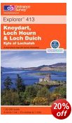
Map: OS Landranger 33
Distance: 9 miles ( 14km )
Time: 5 - 7 hours
Terrain: Mountain walk
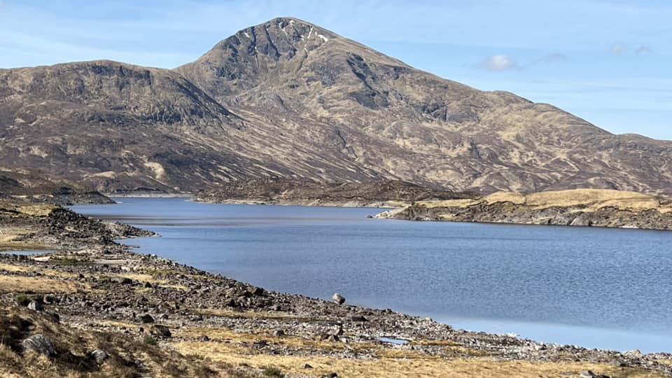
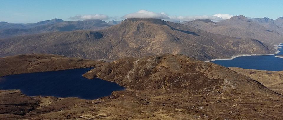
The area around Loch Quoich, just west of Glen Garry, has the distinction of being one of the wettest places in Scotland. In December 1954, 10 inches of rain fell in a 22-hour period and the annual average is in the region of 135 inches. It's not surprising then that the North of 
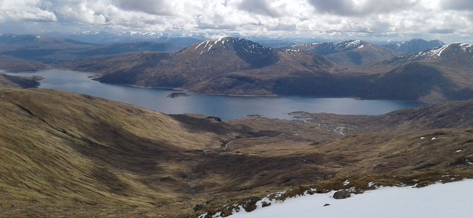
Scotland Hydro Board has harnessed the waters of Loch Quoich for hydroclectricity and in so doing changed what was a seven-mile natural loch into a 10-mile-long reservoir. By raising the waters by 100 feet they drowned the small village of Kinlochquoich and doubled the maximum breadth of the loch. Such loss of human habitation has given the area a real wilderness feel, despite the presence of a single-track road that runs along the north shore of the loch between Glen Garry and Kinloch Hourn.
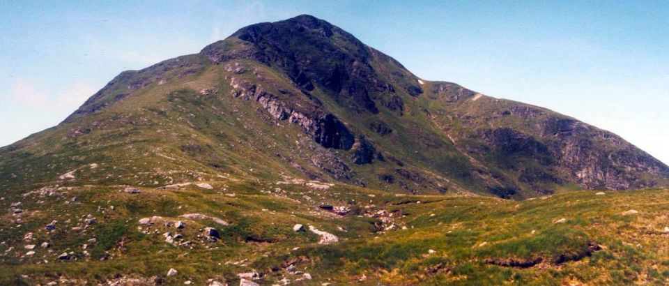
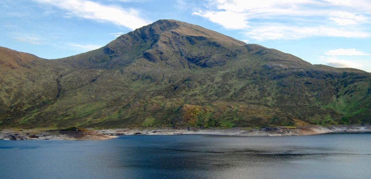
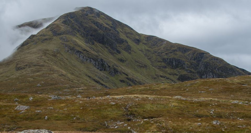
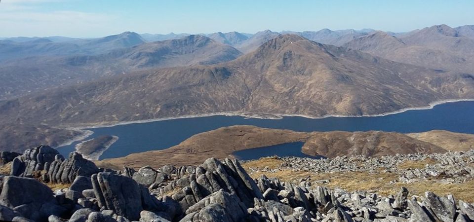
Gairich, 3,0l5ft / 9l9m, stands in splendid isolation on the south side of the loch, gazing across the neck of water towards the Glengarry twins of Gleouraieh and Spidean Mialach. A little way along the road lies another magnificent Munro, Sgurr a’ Mhaoraich. The finest way to climb Gairich would be to canoe across the loch and climb the hill by its broad north ridge. It would then be possible to canoe back across the loch and add Sgurr a‘ Mhaoraich to the day’s tally.
This would also avoid the sometimes horrendously boggy approaches to Gairich on the normal route from the dam on Loch Quoich.
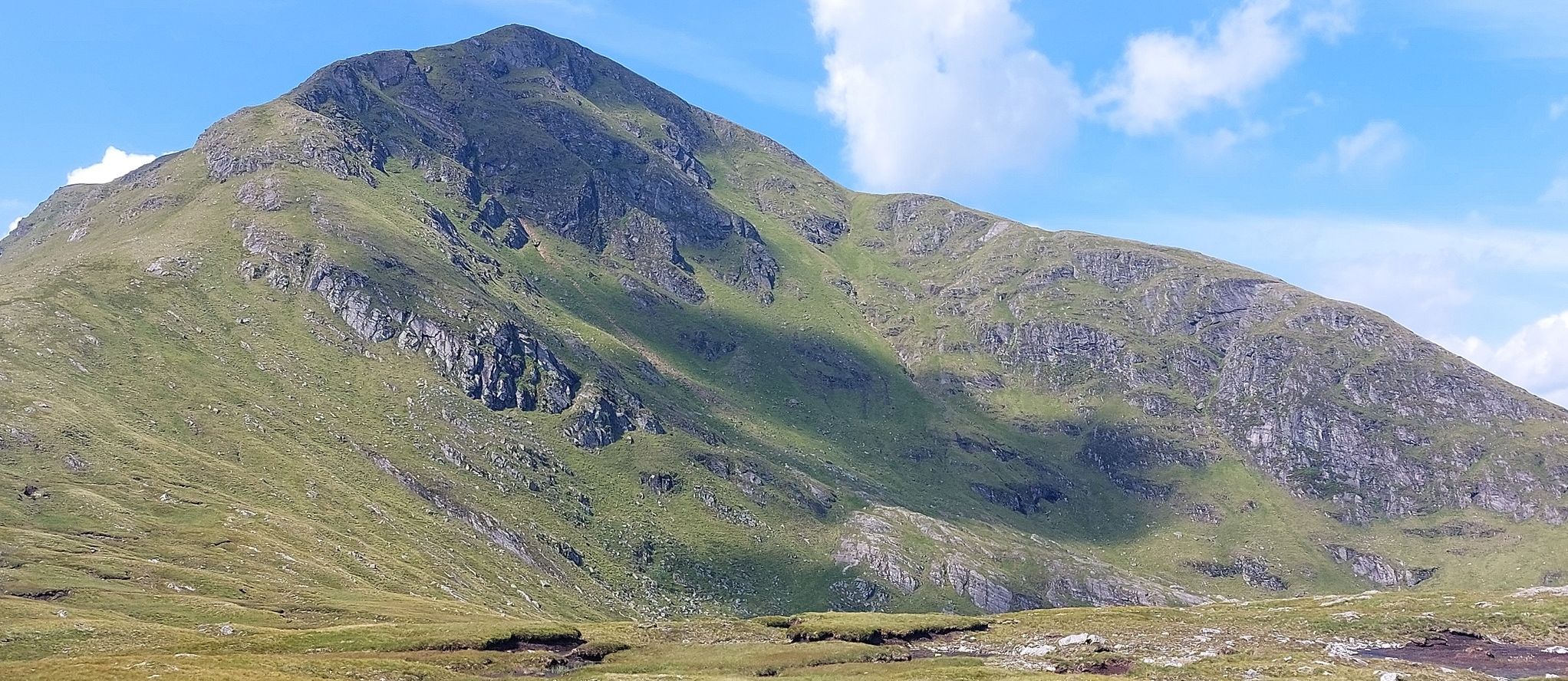
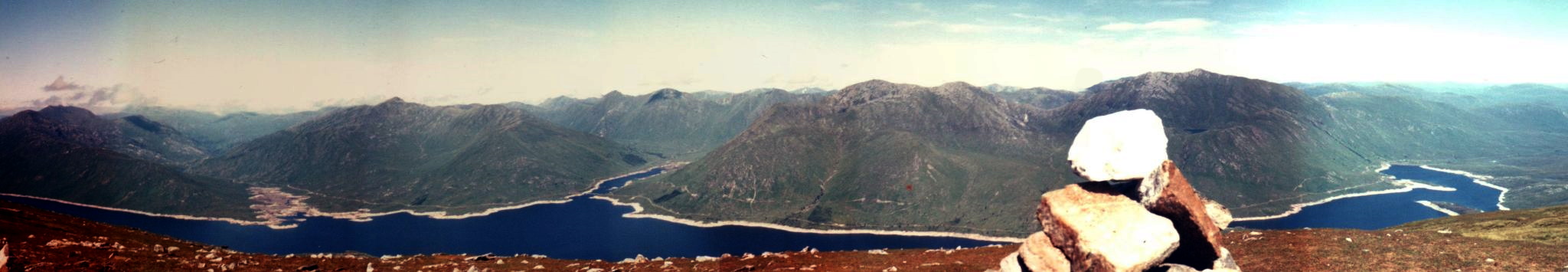
On reaching the crest of the east ridge the ridge widens out on to the Bac nam Foid where it usually becomes increasingly bogy and cut up by peat hags. Soon however the route climbs through rocky outcrops  with various tracks crossing the south-east slopes of the hill and it’s easy to follow them too far west, but by keeping on a rising traverse as close to the crest it is possible  to pick a line through the 
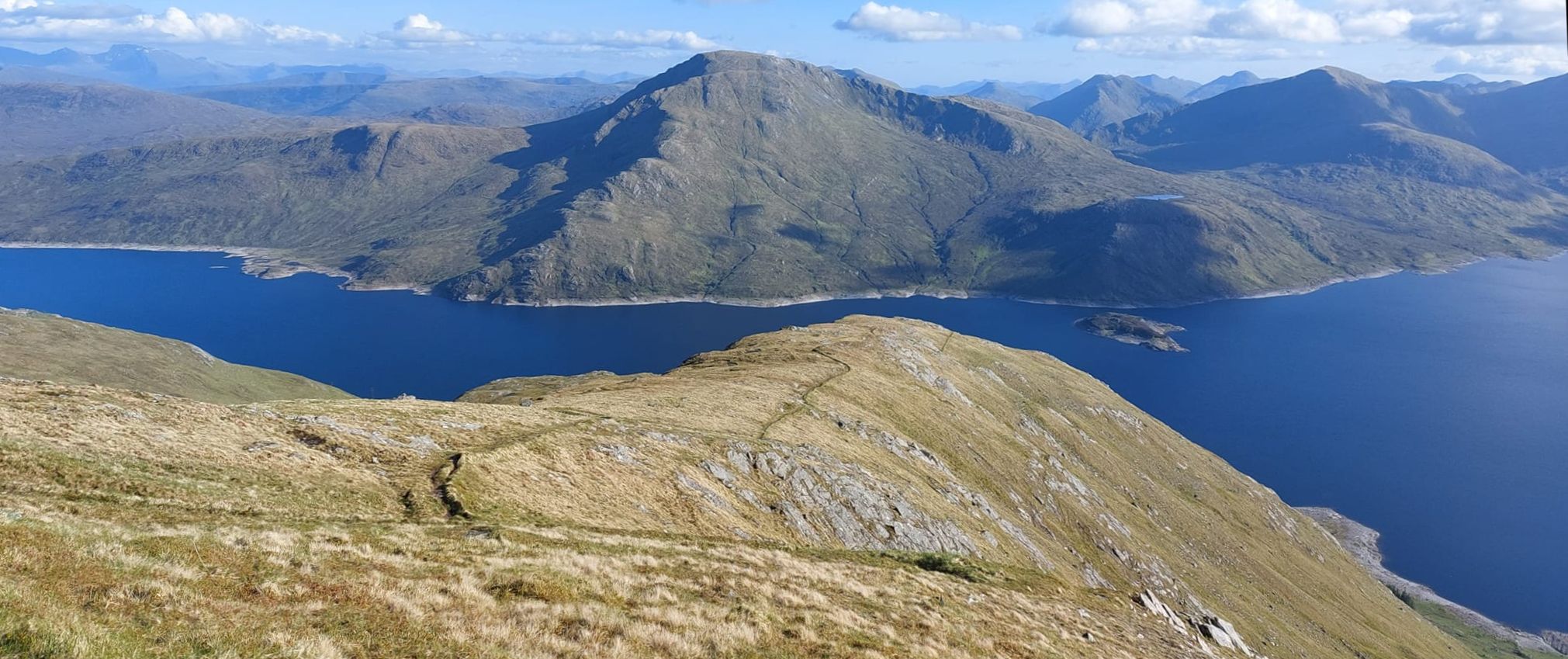
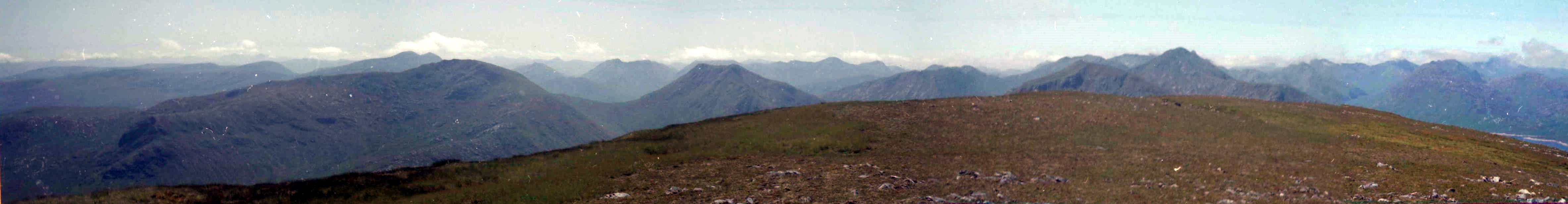
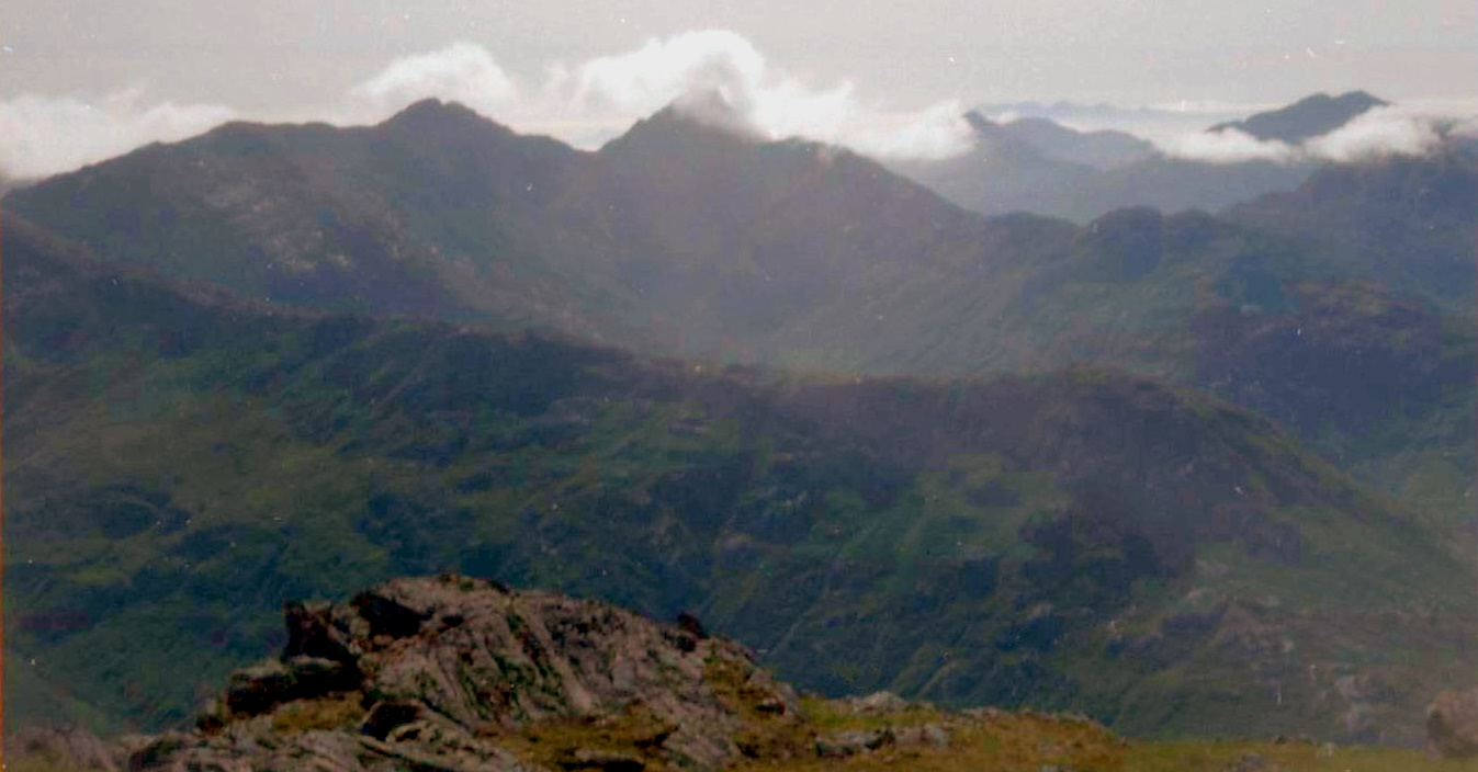
difficulties to the surprisingly broad summit ridge and cairn from where 
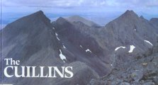
the Cuillin of Skye, Ben Nevis, the Munros to the north of Loch Quoich and best of all, the rough bounds of the Knoydart hills provide a splendid outlook.

Route:

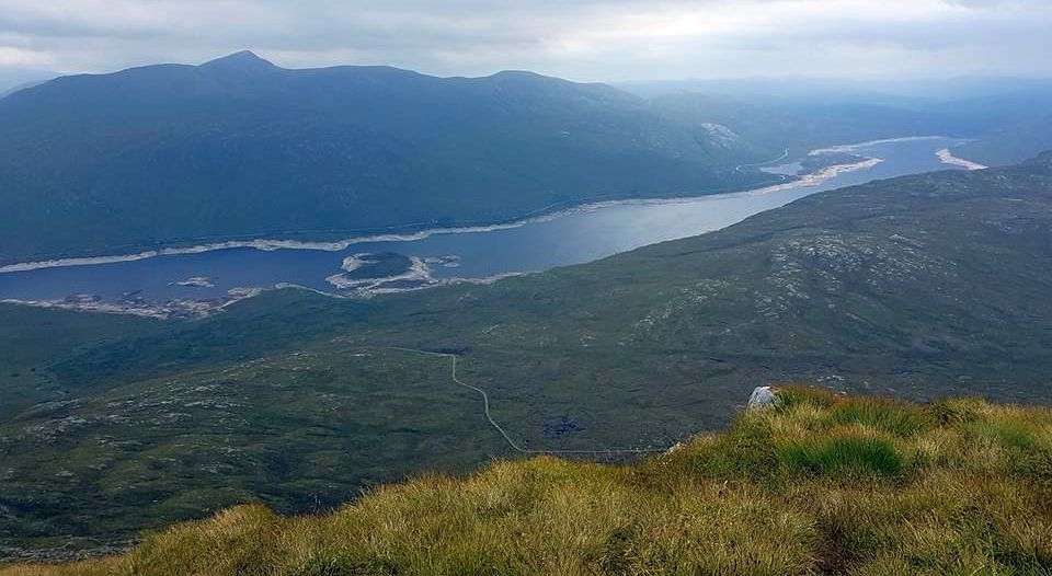
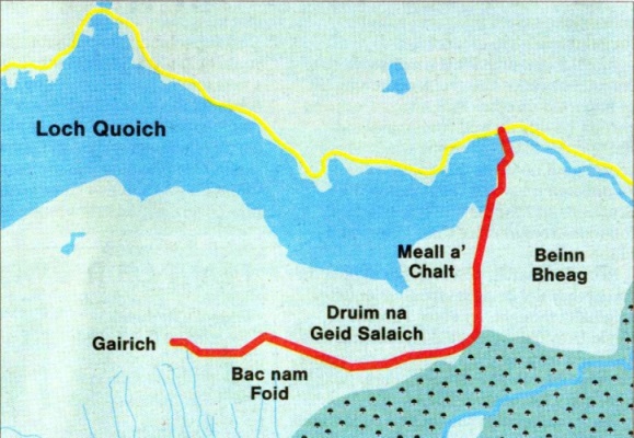
Start / finish at Loch Quoich dam ( GR: NH070024 ).
From the A87 8km west of lnvergarry, take the No Through Road to Kinlochhourn for about 17km to the dam.
From the S end ot the dam a path leads to an old stalkers‘ path that runs S over boggy moors to the edge of a forestry plantation.
Here another path runs due W up the Druim na Geld Salaich.
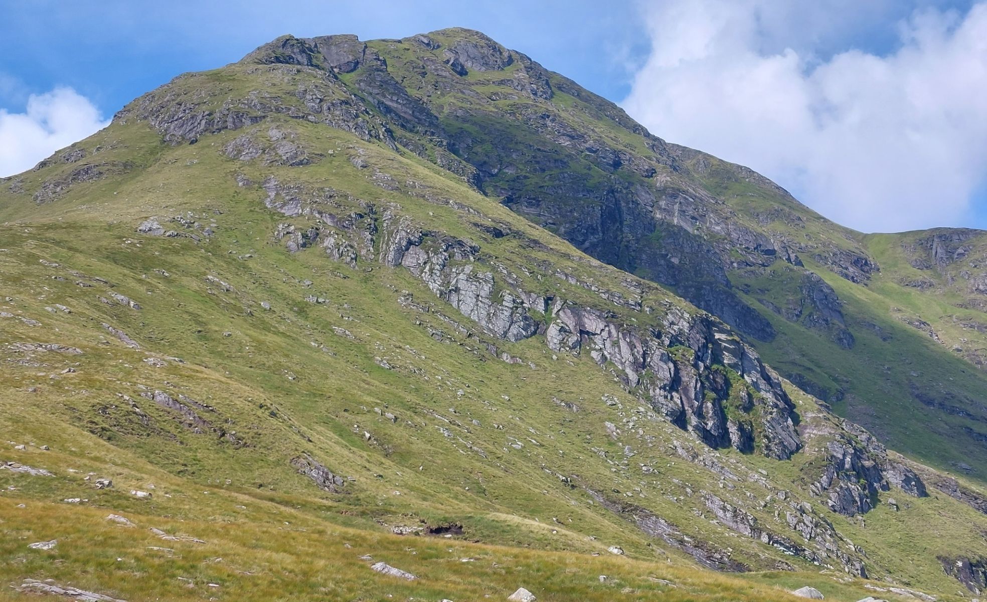
Once the broad ridge crest is reached the path peters out but the going is easy and the broad ridge should be followed W to the final steep pull to
Gairich.
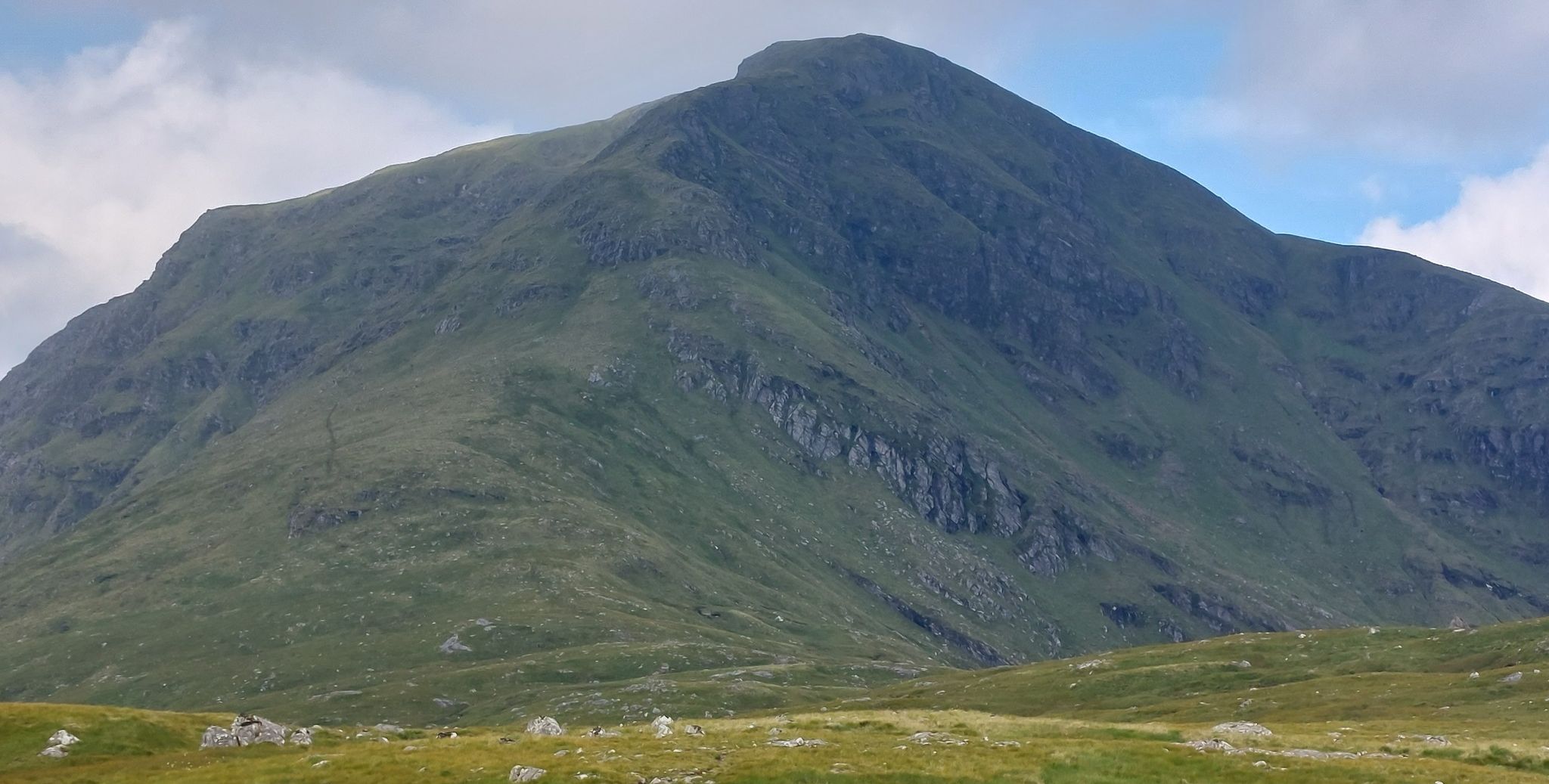
At the toot of this final rise a path reappears, but after a while it runs out on to the S face. Don't be tempted by it but continue climbing on the crest oi the ridge to the spacious summit and large cairn.
Return the same way.


<< BackKnoydart Index : Next >>


Scotland Index :: Scottish Peaks :: Scotland Walks

Ben Nevis | Glencoe | Knoydart | Isle of Skye | Isle of Arran | The West Highland Way

The Eastern Highlands | The Central Highlands | The Southern Highlands | The NW Highlands


Adventure Travel : Worldwide Mountaineering : Site Index

fb icon  google+ icon Linkedin icon  twitter


Guide Books & Maps - Scotland:-


Knoydart, Loch Hourn, Loch Duich - OS Explorer Map Glen Shiel & Loch Hourn - OS Landranger Map Western Scotland & the Western Isles OS Road Map Northern Scotland OS Road MapSouthern Scotland OS Road Map


Knoydart, Skye, Wester Ross - West Coast Walks Knoydart to Morven 

The High Mountains of Britain & Ireland  Munros Tables SMC  The Munros - Scotland's Highest Mountains  Scotland - Lonely Planet  NW Highlands - SMC Guide  Exploring the Far NW of Scotland  Guide to Walks in NW Highlands

Walking in Scotland - Lonely Planet Mountain: Exploring Britain's High Places  National 3 Peaks Walk Scottish Highlands Hillwalking Guide The Scottish Islands Bouldering in Scotland

West Highlands NW Highlands SMC The Munros: Scottish Mountaineering Club The Munros and Tops The Corbetts - SMC Munros & Corbetts Chart The High Mountains of Britain and Ireland Pathfinder Guide: Skye and NW Highlands Walks

Ben Nevis - Scotland's Highest Mountain Ben Nevis: Rock & Ice ClimbsThe High Mountains of Britain and Ireland Rambler's Guide: Ben Nevis and Glen Coe Winter Climbs: Ben Nevis and Glencoe Ben Nevis Rock & Ice Climbs Great Snow & Ice Climbs of the British IslesPathfinder Guide: Fort William and Glen Coe Walks Scrambles in Lochaber

Scottish Winter ClimbsMunros & Corbetts Chart Call of the Corbetts Wilderness Walks 2 - Video

Rock Climbing in Scotland Classic Mountain Scrambles in Scotland Scotland - Lonely PlanetScotland's Highlands & Islands - Lonley Planet Scotland's Highlands & Islands - Rough Guide Highlands & Islands of Scotland - Hidden Places Scotlands 100 Best WalksCentral Highlands: Six Long Distance Walks Rough Guide Scotland

Scottish Highlands & Islands - Rough Guide The Munros - Scotland's highest mountains My Scotland by Hamish MacInnes Scottish Mountains - 50 Classic RoutesThe Cuillins Scottish Mountains - 100 Best Routes

Munro Almanac The Munros Map The Munros: Scottish Mountaineering Club The Isle of Skye The Isle of Arran Wilderness Walks Ski Mountaineering in Scotland Classic Walks in Britain & Ireland

More Wilderness Walks 50 Best Routes on Skye and Raasay Skye - W.A.PoucherMagic of the Munros Mountaineering in Scotland and Undiscovered Scotland by W.H.Murray A Long Walk on the Isle of Skye

Classic Climbs - Central & Southern Highlands The Isle of Arran Lonely Planet, Walking in Scotland Pathfinder Guide: Skye and NW Highlands Walks50 Best Routes on Skye and Raasay - Chris Townsend 100 Best Routes on Scottish Mountains Scrambles in Skye Mountain Days & Bothy Nights

Walking in the Hebrides Torridon: A Walkers Guide Ski Touring in ScotlandRough Guide: Scotland A Mountaineer's Tale - W.H.Murray Dougal Haston: Philosophy of RiskOne Man's Mountains - Tom Patey Big Walks of Great Britain

The Glens of Rannoch Cairngorm Glens Glens of Trossach Knoydart to Morven Scottish Glens: The Atholl GlensSouthern Highlands - Map Northern Highlands The Munro Show 1 & 2 - Muriel Gray

The Cairngorms Cairngorms Walks Cairngorm - Map Walks in the Cairngorms Lochnagar & Glenshee - Map The Cairngorms of Scotland Cairngorms - Mountain Bike Guide Winter Climbs in the Caingorms

West Highland Way: Official GuideWest Highland Way: Rucksac Readers West Highland Way: TrailblazerThe West Highland WayWest Highland Way: Footprint MapWest Highland Way - Map West Highland Way - Map 100 Hillwalks around Glasgow

50 Walks in Glasgow & SW Scotland 50 Walks in the Scottish Highlands & Islands 50 Walks in Edinburgh & Eastern Scotland 100 Walks in ScotlandVisit Scotland - Touring Guide Scotland: Where to Stay - Hotels & Guest Houses Scotland: Where to Stay - Bed & Breakfast Walking the Munros Vol 2: Northern Highlands & CairngormsWalking the Munros Vol 1: Southern, Central & Western Highlands

Hillwalker: The MunrosHillwalker: The Corbetts Weather for Hillwakers & Climbers Mountain Weather Guide to the Weather Weather: Collins Gem Hillwalking Handbook for Mountain Leaders First Aid on Mountains

All Mountain Skier Off Piste World's most significant Climbs Mountain Travellers HandbookMountaineering: The Freedom of the HillsHillwalkers Guide to Mountaineering 200 Challenging Walks in Britain & Ireland

Ice & Mixed Climbing How to Ice Climb Complete Climbers Handbook Mountain Skills Training Handbook Autumn Road to the IslesDiscovering Scotland - Atlas & Guide Scotland Travel Guide Lonely Planet Scotland - The Wild Places - Colin Prior


Google Analytics


Google Analytics

extremetracking
 eXTReMe Tracker


extremetracking
Sitelock caingram.com
SiteLock
Sitelock
Sitelock caingram.info
SiteLock
Sitelock