  |
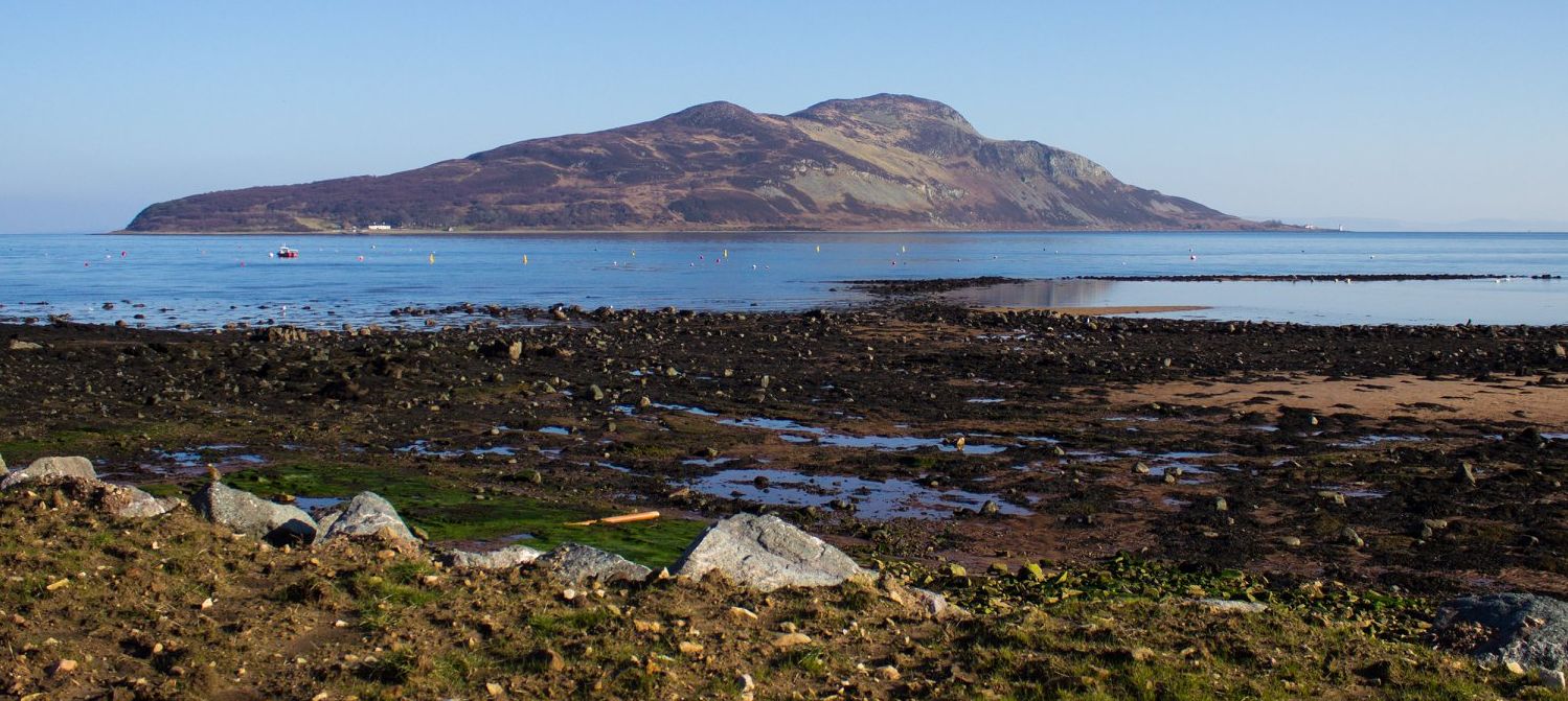
Isle of ArranHoly Isle
|
  |
| |
Isle of ArranHoly Isle
|
|
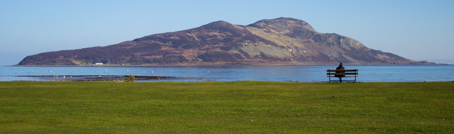
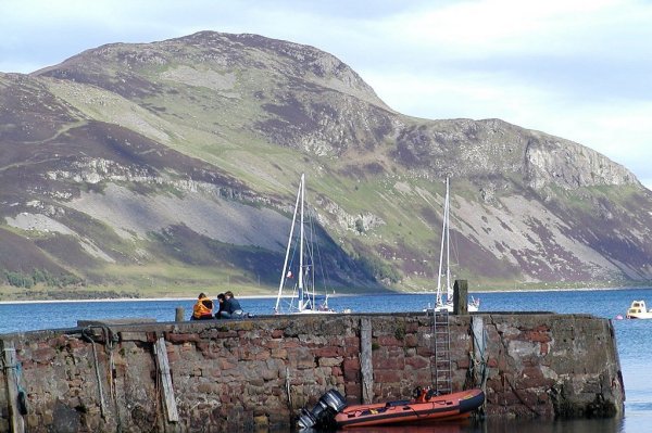 Holy Isle from Lamlash Pier Holy
Isle has a long history
as a sacred site. It has a spring that is claimed to have healing properties. |
 Holy
Isle
from Lamlash |
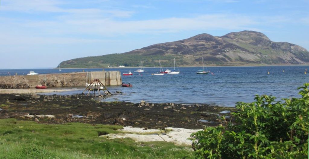 Holy
Isle
from Lamlash |
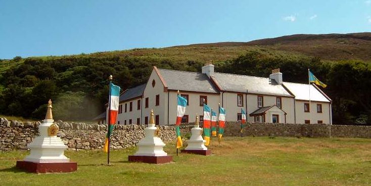 Buddhist
World Peace &
Health Centre
on the Holy Isle |
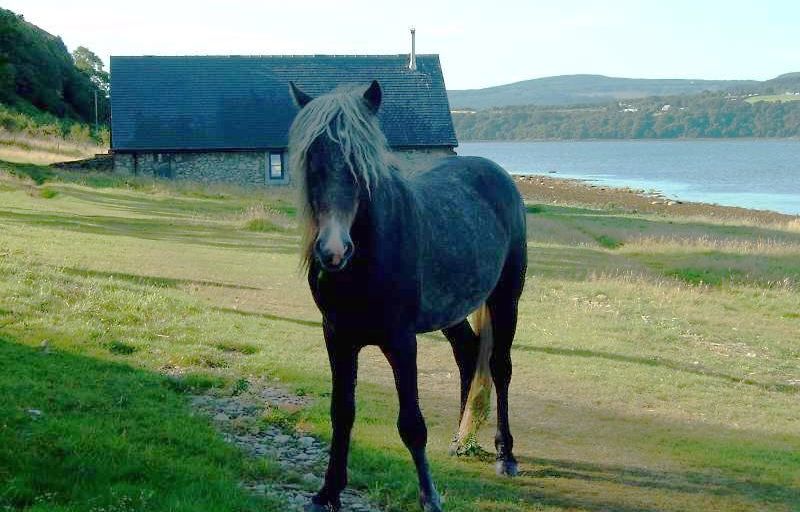 Eriskay
Wild Pony
on the Holy Isle in the Firth of Clyde |
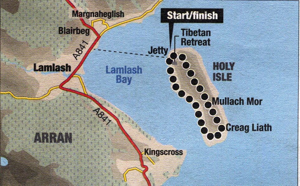
HOLY ISLE WALK - ROUTE DESCRIPTION
Location: Arran
Map: OS Landranger 69
Distance: 4 miles ( 7km )
fime: 3-4 hours
Grade: moderate hill walk
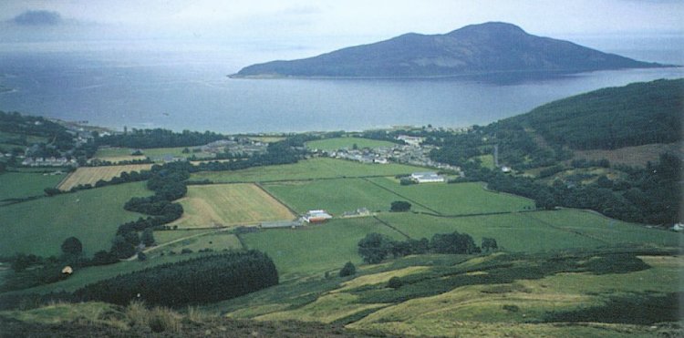
You could be approaching a Nepalese monastery but instead of gazing on Himalayan peaks you are looking across Lamlash Bay
at the notched outline of the mountains of Arran. A tiny ferry whisks you across the bay to Holy Isle, just off Arran’s south-east coast.
Holy Isle is run as a Tibetan Buddhist centre but its spiritual heritage stretches back to the sixth century when the
Celtic missionary who became known as St Molaise lived there.
At only 314 metres, Mullach Mor is the island’s highest point, reached through a gateway of prayer flags,
up the edge of a tilting field, over a stile, along a rutted footpath and through a recently planted native woodland area.
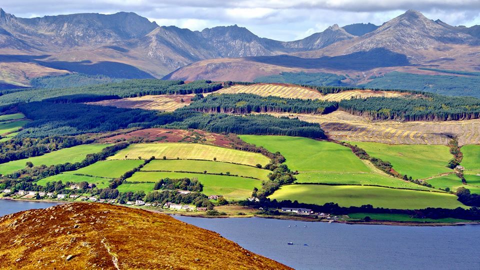
Emerging from the trees all the big hills of Arran are visible to the north across the shimmering waters of
Lamlash Bay - Cir Mhor, the A-Chir Ridge, Beinn Tarsuinn and Goat Fell, the highest of them all.
The island has two tops, and it was a steep climb to the first of them, Mullach Beag. No wonder ancient and contemporary monks
and lamas have chosen this as their place of meditation and prayer, for its beauty heightens the senses and confronts you with
the glory of nature, whatever your religious beliefs.
A steep descent from Mullach Beag is followed by an even steeper climb to the main summit, Mullach Mor, from where you can
appreciate the views. To the east the hills of Ayrshire are low-lying but closer at hand, beyond a green and yellow patchwork of fields, lie
the rugged hills of Arran. And at your feet, across the peaceful waters of the bay, lie the houses and buildings of Lamlash, white
and glistening in the sun.
The descent from Mulloch Mor is badly eroded and steep. The rest of the walk, to the lighthouse ( now the Inner Light Retreat for
women ) and back up the west coast, is quite beautiful.
As you make your way along the grassy track that runs up the west of the island, you pass a number of colourful rock paintings that
depict Buddhist deities and teachers. Beyond these lies the Holy Well and cave of St Molaise.
The cave is indicated with a sign pointing up some steps, and just beyond it bubbles the Well where, for centuries, people have come to
drink the reputedly healing water.
Make your way back to the Centre for World Peace and Health and explore the organic garden before leaving the island and returning to Lamlash.
Glencoe | Ben Nevis | Knoydart | Isle of Skye | Isle of Arran | The West Highland Way
The Eastern Highlands | The Central Highlands | The Southern Highlands | The NW Highlands