  |
The Scottish HighlandsLiathach
|
  |
| |
The Scottish HighlandsLiathach
|
|
 |
|
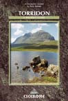
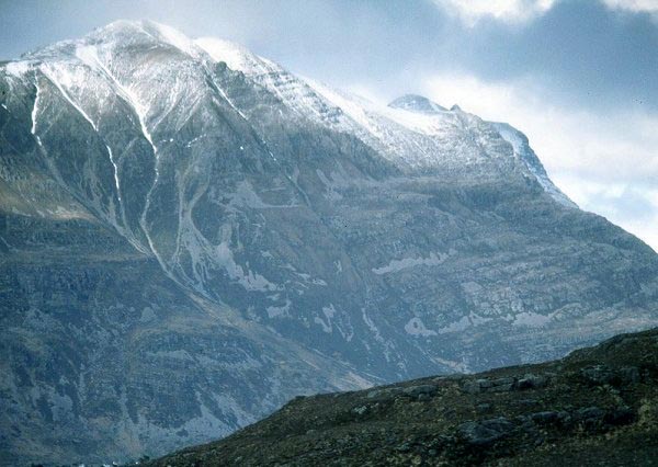
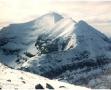
 Liathach
from Beinn Eighe
|
|
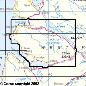
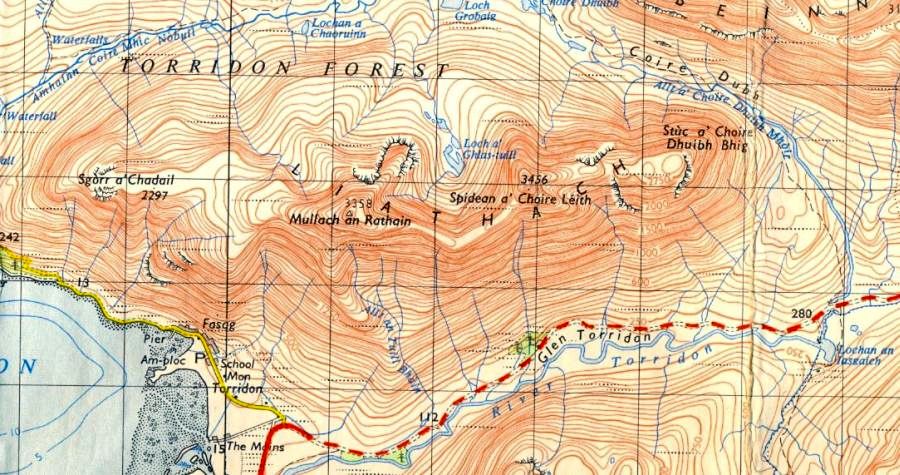 Map for
Liathach
|
|
LIATHACH - ROUTE DESCRIPTION:
Location: Torridon
Map: OS Landranger 25
Distance: 7 miles ( 12km )
Time: 7-8 hours
Grade: Serious mountain walk
Liathach, the Grey One, with tiers of sandstone stacked into the sky
It looks impossible to climb - hillsides often look vertical when looked straight on at them.
Liathach isn’t impregnable, but it is a serious undertaking.
With two Munro tops it is surprising that more hillwalkers don't come to grief on this giant.
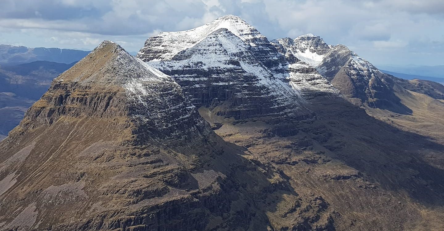
The mountain's ridge is a convoluted one, crossing six lesser tops as well as the two Munros, Spidean a‘ Choire Leith ( 3461ft / 1055m )
and Mullach an Rathain ( 3356ft / 1023m).
The usual ascent route starts just east of Glen Cottage in Glen Torridon and climbs to the steep upper slopes of Toll a‘ Meitheach, a shallow corrie high on
the hill's sandstone flanks.
The path runs alongside the Allt an Doire Ghairbh as it rushes down over its rocky steps. Rocky crags and steep grassy slopes intermingle before
the path climbs over a break in a rock band that appears to cross the face of the mountain.
Then it’s a steep scramble into the upper reaches of the corrie where a scree-filled gully gives access to the ridge itself, just west of Bidein Toll a’ Mhuic.
This is a good place to stop, the sweaty work of the day now over. Ahead the long ridge of Beinn Eighe stretches eastwards.
In the other direction the twisting ridge wriggles towards the triangular-shaped face of Spidean a’ Choire Leith, the first of the Munro summits.
Despite the rock and loose scree the ridge poses little difficulty, first of all flowing in a north-westerly direction, then west over a couple of subsidiary
tops, before the final boulder covered slope to Spidean’s summit.
This is the most elevated point on Liathach and the views are extensive, all the way from Ben Hope in the north to Ben Nevis in the south.
Chances are you won't even notice the views because your eyes will be set on the spectacular outline of the ridge ahead. This is where the ridge
narrows for a good 2km and for much of its length it is broken and shattered into a series of spectacular spires - the Fasarinen Pinnacles, the ancient sentinels of Liathach.
These fall away dramatically into Coire na Caime on the north side, one of a number of north-facing corries that make up the other face of Liathach, a
more broken and less austere aspect that is hidden from Glen Torridon. A traverse across the summits of the Fasarinen Pinnacles
is a wonderfully airy and exposed scrambie and those with some experience of rock climbing will seek out the holds willingly.
Others will be happy to follow an exposed but well-used footpath that contours the southern side of the pinnacles.
This path leads to the second Munro of the hill, Mullach an Rathain, the aptly named hill of the row of pinnacles.
A wide, grassy ridge leads to the summit and the OS pillar. To the north a short, stony arete runs out to the highest of the pinnacles and the
lower peak of Meall Dearg overlooks Coire na Caime.
A long ridge runs westwards down to the subsidiary top of Sgorr a’ Chadail with fabulous views across Loch Torridon.
The best descent route goes west and south of the summit cairn, dropping towards a broadening slope of broken, scree-filled gullies and worn terraces and
then down towards the road alongside the Allt an Tuill Bhain.
Route:
Start and finish at the A896, 800m east of Glen Cottage ( GR: NG937566 ).
Just E ot Glen Cottage climb steeply up the craggy hillside into the Toll a’ Meitheach.
Higher up the corrie continue NE over sleep ground to the col on the main ridge.
Follow the ridge NW then west over two tops to the cone of Spidean a’ Choire Leith.
Descend SW to a level grassy section.
Continue over, or around the pinnacles of Am Fasarinen. An exposed path avoids the difficulties on the S side.
Beyond the pinnacles it's an easy stroll to Mullach an Rathain.
From the summit the descent back to Glen Torridon is via the SW ridge, although a slightly quicker descent to Glen Torridon
is via the corrie of the Allt an Tuilt Bhain.
Ben Nevis | Glencoe | Knoydart | Isle of Skye | Isle of Arran | The West Highland Way
The Eastern Highlands | The Central Highlands | The Southern Highlands | The NW Highlands