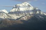

From the dam on Phewa Tal ( tal - lake ) in Pokhara, unfolds one of the finest panoramas of the Nepal Himalaya. On a clear day the northern horizon is lined with giant, ice-bound peaks extending from the Lamjung and Manaslu Himal in the East, through the long, semi-circular sweep of the Annapurna Himal, encompassing the spectacular Macchapucchre - the fishtail mountain ( maccha - fish, pucchre - tail ), to the huge white dome of Dhaulagiri.
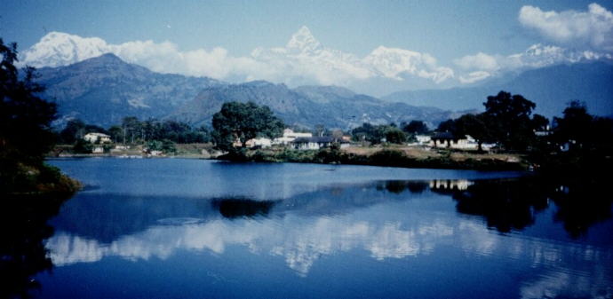 Annapurna Himal and Macchapucchre from Phewa Tal at Pokhara |
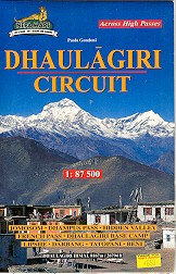
The base camp for Dhaulagiri, the most westerly of Nepal's octet of 'eight-thousanders', ( mountains over 8000 metres in height ), is secreted deep within a vast complex of himalayan peaks with 17 summits over 7000 metres. Two approach routes, radically different in nature, are possible and can be combined to make a difficult and demanding circuit of the world's seventh highest mountain - one of the most challenging and least frequented of the base camp treks.
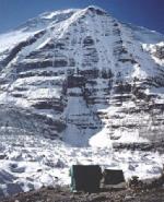
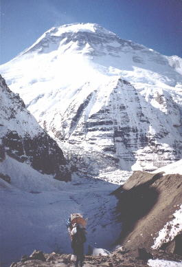
The southern approach from Pokhara follows the course of the Myagdi Khola, initially through traditional farms and villages in its lower reaches, then dense jungle and uninhabited wilderness in its upper gorge, to reach its source in the mighty Chonbarden Glacier. A long, arduous ascent over rough moraines is followed by a dangerously crevassed section before gaining the site for expedition base camps beneath the dramatic, 'Little Eiger' face of Dhaulagiri.
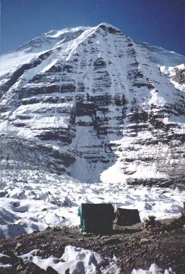 Base Camp beneath the Little Eiger Face of Dhaulagiri |
The northern approach, pioneered by Herzog's expedition in 1950, starts near Jomson in the Kali Gandaki valley and entails the crossing of two, high, snow-covered passes:- firstly the Thapa Pass into the isolated 'Hidden Valley', and secondly a re-ascent to the 'French Col' before descending into the innermost recess of the Chonbarden glacier.
In Pokhara my sirdar, Tenzing Sherpa, had problems recruiting porters. It was Dasain, one of the two main Nepalese festivals ( the other is Tihar a few weeks later ), and everyone wanted to remain at home for the celebrations.
A day behind schedule we left in a grossly overcrowded local bus for the three hour journey over pot-holed roads through lush paddy fields and terraced foothills to our trek start point at the village of Kusma. Our route then followed the level banks of the Kali Gandaki through unspoilt countryside to its confluence with the Myagdi Khola at the major town of Beni.
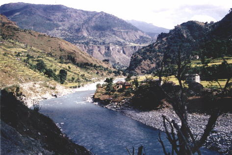 Kali Gandaki on approach to Beni |
As we approached the town two policemen were attempting to retrieve something lodged amongst boulders in the swiftly-flowing waters. I was horrified to find it was the body of a local villager murdered by robbers. Fortunately attacks on trekkers are extremely rare, but not unknown, with the main problem confined to petty thefts during the night from campsites - bad enough if a camera or other piece of essential gear is stolen. On a previous trek in the Ganesh Himal I had had the sides of my tent slashed with a razor blade and my 'Goretex' jacket, medical kit and a stuff bag with most of my clothes surreptitiously removed. At notorious locations the Sherpas of trekking groups mount an allnight guard to deter intruders.
Proceeding through the narrow, flag-stoned streets between the two-storied, stone-built houses with their corrugated-iron roofs, we pitched our tents at the riverside on a grassy flat beside a school. A crowd of smiling, friendly children soon surrounded us and I chatted with them in a mixture of pidgin Nepali ( mine ) and broken English ( theirs ).
A few days later we crested a ridgetop to gain our first view since leaving Pokhara of the snow peaks - a splendid panorama of the Gurja Himal forming a magnificent backdrop to the picturesque Magar village of Darapani amidst fields of bright yellow, oil-seed rape.
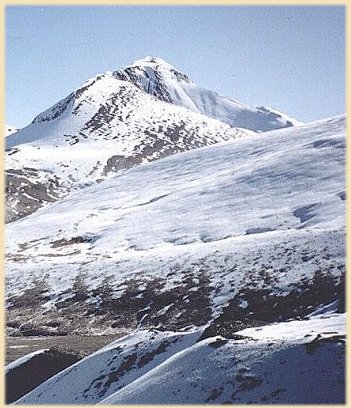
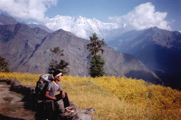 Gurja Himal from Muri |
Leaving our campsite in the small farming community of Muri we entered the deep, narrow upper valley of the Myagdi Khola and, beyond the last small settlement of Baghara, with its simple wickerwork huts, continued for two days on faint trails through dense, leech-infested jungle. Insecure tree-trunks formed rudimentary bridges across raging sidestreams. High waterfalls cascaded down the valley sides.
Emerging from forests of tall pine trees we climbed over open scrubland to encamp at 'Italian Base Camp' overlooked by the immense precipices of the West Face of Dhaulagiri and the opposing heights of Tsaurabong Peak and Dhaulagiri V.
A narrow canyon between sheer rock walls gave access to the Chonbarden Glacier. It was hard, awkward going over the rough, convoluted moraines but this was alleviated by the increasing grandeur of our surroundings. Towards midday, still in the middle of the glacier and still a long way to go, Nima, my cook, and Pasang, our kitchenboy, primed up our two kerosene stoves to produce an excellent and very welcome 3-course meal.
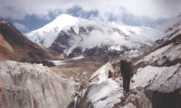 Tukuche Peak from the Chonbarden Glacier on approach to Base Camp |
Care had to be taken when crossing narrow ice-bridges between yawning crevasses before we emerged onto the upper, flatter glacier. Altitude was then the only problem on the final stretch.
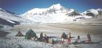
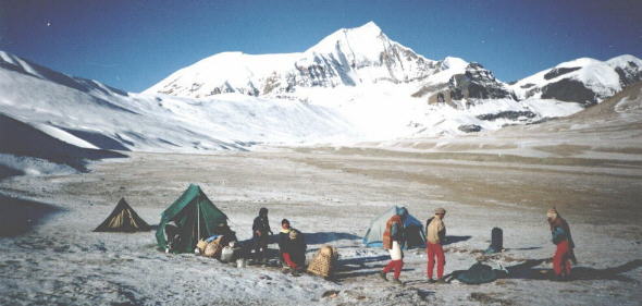
Situated on the stony surface of a lateral moraine, directly beneath the towering 'Little Eiger' face, the main expedition base camp for Dhaulagiri commands a superb vista down the glacier to a great ridge of 7000 metre peaks:- Dhaulagiri II, Dhaulagiri III and Dhaulagiri V. Only a short distance away, at the head of the glacier, huge avalanche cones sweep down from the massive Tukuche Peak.
 View down Chonbarden Glacier from Base Camp |
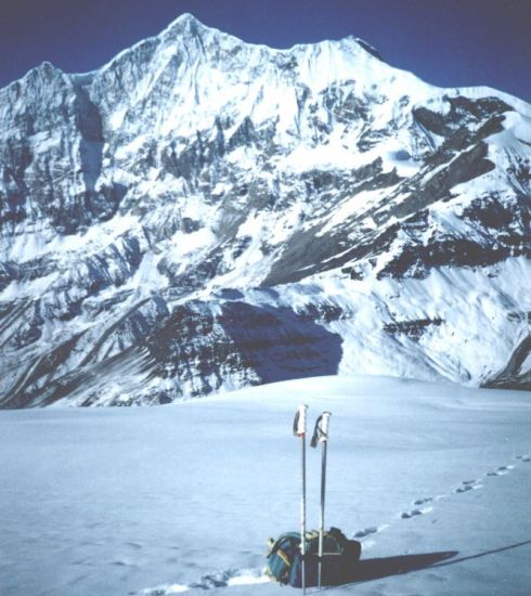
A rest day was spent acclimatizing to the 5000 metre altitude amidst the awesome, austere, arctic beauty of the surrounding snow-covered mountains and tumbling ice-falls before continuing upwards to the 'French Col'. As we climbed the ridge above base camp the full immensity of Dhaulagiri I was slowly revealed in all its glory.
 Dhaulagiri I on ascent to French Col |
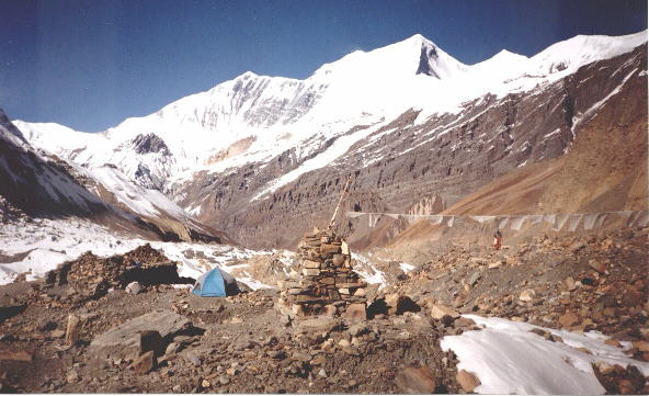
From the twin cairns on the wind-swept pass we descended to encamp in the brown, barren wilderness of the 'Hidden Valley' enclosed by a ring of himalayan peaks. Vast ice-fields fell from the summit of Tukuche Peak towards the 'French Col' on its western flank and, on its northern, to Thapa Pass - our escape route back to the Kali Gandaki. At the valleyhead above 'French Col' soared the shapely snow pyramid of Sita Chuchura.
 Mt. Sita Chuchura from camp in the Hidden Valley |
It was an easy half day across the snow slopes of Thapa Pass to our next campsite on gravel flats beneath Thapa Peak but others have not been so fortunate. Tenzing indicated a mound of stones marking the grave of a porter who had succumbed in blizzard conditions the previous Spring. "We also will probably die on this trek", opined Chandra, the leader of our four local, Magar porters, veterens of many previous crossings.
 Thapa Peak from Hidden Valley |
Early next morning I climbed alone over untracked snowfields towards the 6000 metre summit of Thapa Peak. On a steeper slope I had to kick steps before a final, airy scramble up a rocky ridge achieved a superb vantage point.
 Tukuche Peak on ascent to Thapa Peak |
Far below I could retrace our route over Thapa Pass into 'Hidden Valley' and up to 'French Col' nestling beneath Mt.Sita Chuchura and the great ridge of Dhaulagiris II, III, and V. Directly opposite loomed the tremendous North Face of Tukuche Peak. The summit of the reigning Dhaulagiri I was only just visible. To the East, the peaks of the Annapurna Himal formed a great barrier above the deep, dark chasm of the Kali Gandaki.The 8000 metre Annapurna I, the ultimate objective of Herzog's expedition, was clearly visible jutting proudly above the subordinate Tilicho and Nilgiri peaks.
Tenzing and Nima ambled leisurely up bringing a packed lunch. Not a breath of wind spoiled our enjoyment of our lofty viewpoint in warm sunshine beneath azure skies - a himalayan highlight to be long remembered.
( The Weekend Extra, The (Glasgow) HERALD, Saturday 21st June 1997 )
Himalaya Map - Nelles ( UK , USA )
Nepal Trail Map - Nelles ( UK , USA )
Nepal Himalaya Map 2: Mid-West Nepal, Jumla/Rana, Saipal, Sisne Himal
Nepal Himalaya Map 4: Annapurna, Machhapuchhare, Marsyangdi & Muktinath